


Things to Do
Best Fall Color Hikes in Southwest MO
When hues of scarlet and gold emerge and sunny days dawn crisp and clear, nothing beats the crunch of fallen leaves along an Ozarks trail. Lace up your boots, grab your camera and hit one of these trails for leaf-peeping—and then some.
By Sony Hocklander
Nov 2016
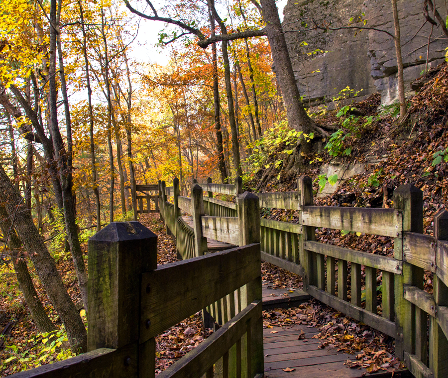
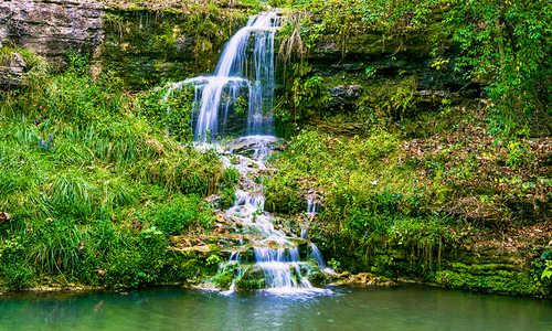
Photo by Sony HocklanderGet out and enjoy all of falls colors on a hike through the Ozarks.
State Park Day Trip
Deer Leap & Devil's Kitchen Trails
Level: Strenuous
Kid-friendly: Older youth
Lengths: 0.2-mile and 1.5-mile loops
Best shots: Hatchery and spring overlook views, rock formations, caves
Bonus: Spring, hatchery, fishing area
Location: Roaring River State Park near Cassville; drive time 1.5 hours
Why it’s great: Plan a picnic and spend the day—or do a little fishing. There’s plenty to explore in addition to your hikes. Park at the scenic hatchery where Deer Leap and Devil’s Kitchen trailheads are in close proximity. The short but steep Deer Leap Trail starts near the gorgeous blue-green Roaring River Spring. Stone steps lead uphill where the bluff-top trail continues with bridges, boardwalks and scenic overlooks showcasing the spring, pool and hatchery. The rugged Devil’s Kitchen Trail, across the river, features caves and rock formations including a collapsed room-like enclosure that inspired the trail’s name.
Buffalo River Views
Ponca to Steel Creek
Level: Moderate to easy
Kid-friendly: Older youth
Length: 4 miles out and back
Best shots: River overlooks, cascades, rock formations
Bonus: “Beaver Jim” Villines homestead near Ponca trailhead
Location: Across the Ponca, Arkansas, low water bridge; drive time 2 hours
Why it’s great: This section of the Buffalo River Trail climbs roughly 300 feet, affording wonderful overlook views to the curving river below. The trail features interesting rock formations—including a split rock you’ll pass through—and, during high water, several pretty cascades crossing the trail. Plan extra time to visit the old preserved Villines homestead, which is uphill from the Ponca trailhead.
Scenic Waters
Kings River Falls Trail
Level: Easy
Kid-friendly: Yes
Length: 2 miles out and back
Best shots: Waterfall, pool
Bonus: Side trail with cascading falls
Location: Kings River Falls Natural Area, Witter, Arkansas; drive time 2.5 hours
Why it’s great: Few scenes beat Kings River Falls, especially with a backdrop of crimson and gold. Don’t rush this family-friendly hike: Smaller cascades and natural beauty should be savored as you go. While the falls at trail’s end are at their best in high water, you’ll want to linger even if the river is low. And with trees shedding summer wardrobes, you’ll more easily find a volunteer trail just upstream from the falls, leading to more cascades.
Fall Color with Cardio
Bluff Trail
Level: Strenuous
Kid-friendly: Older youth
Length: Nearly 1.5 miles out and back
Best shots: Stone wall, grotto, Civil War cave
Bonus: Kid-friendly trails and picnic areas around Lyle Owen Homestead
Location: Lakeside Forest Wilderness Area in Branson; drive time 50 minutes
Why it’s great: Located just off 76 Country Boulevard, this scenic trail serves up a workout via 315 stonework steps tucked into a 140-acre sanctuary that includes more than four miles of trails. Those include family-friendly paths around the Owen Homestead area (under renovation after a 2015 fire gutted the house). Before descending Bluff Trail, pause at the hand-built stone wall which overlooks glistening Lake Taneycomo. This trail also leads to a grotto (with a waterfall during wet seasons) and two caves, the second of which is a Civil War hideout.
Close and Convenient
Busiek Red Trail
Level: Moderate
Kid-friendly: Mid-elementary and older youth
Length: Roughly 3-mile loop
Best shots: Hillside fall cover overlooks, Woods Fork Creek crossing
Bonus: Carter Family Cemetery
Location: Busiek State Forest and Wildlife Area near Highlandville; drive time 30 minutes
Why it’s great: Busiek’s east side Red Trail winds through wooded areas and climbs to hilltop vistas affording nice fall color views. Photo-friendly landmarks include the Carter Family Cemetery (established 1891) and Woods Fork Creek. Prepare to cross the creek once without a bridge—several times if you connect to the Yellow Trail.