


Travel
Explore the Lakeshore on Minnesota's North Shore Scenic Byway
Explore lakeshore, mountains and waterfalls along Minnesota’s North Shore scenic byway on Lake Superior. It’s a driveable trip that feels a world away.
by Sony Hocklander
Sep 2025
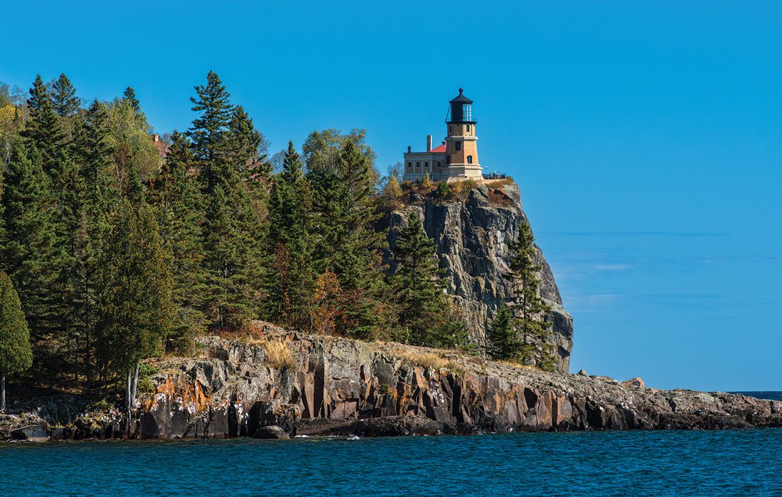
Photo by Sony Hocklander
Rock-strewn beaches, soaring bluffs, quaint towns, historic lighthouses and scenic points of interest dot the coast of Lake Superior—all reason enough to explore Minnesota’s North Shore between Deluth and Canada. Most enticing are streams and rivers that cascade toward the shore, creating 17 named waterfalls and many more along the 151-mile North Shore Scenic Drive, also known as Scenic 61 Highway. Eight state parks around the most prominent streams make them easy to reach.
Last fall, we camped at Black Beach in the Silver Bay area and took day trips from there. It was a fantastic time to visit for waterfall chasing paired with leaf peeping. Perhaps these highlights will inspire your road trip to one of our new favorite regions.
Photos by Sony Hocklander
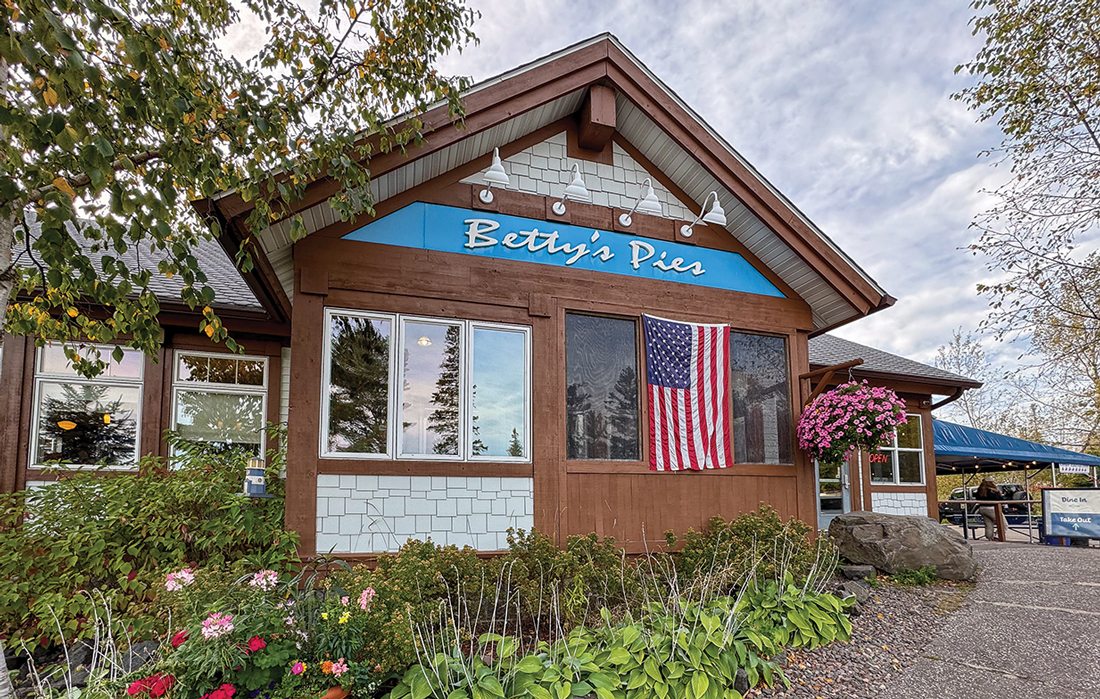
Two Harbors is home to Betty’s Pies and Gooseberry Falls State Park.
Two Harbors, Gooseberry Falls and Split Rock Lighthouse
The town of Two Harbors, at Mile 26 of Scenic 61, is the gateway to some of North Shore’s most visited points of interest. It’s also home to the state’s oldest operating lighthouse, circa 1892. Nearby, walk the trail in Agate Bay and a long dock to the 1895 breakwater lighthouse. We found Castle Danger Brewery a refreshing stop for a craft beer and food truck fare. And no visit is complete without pastry from the famous Betty’s Pies.
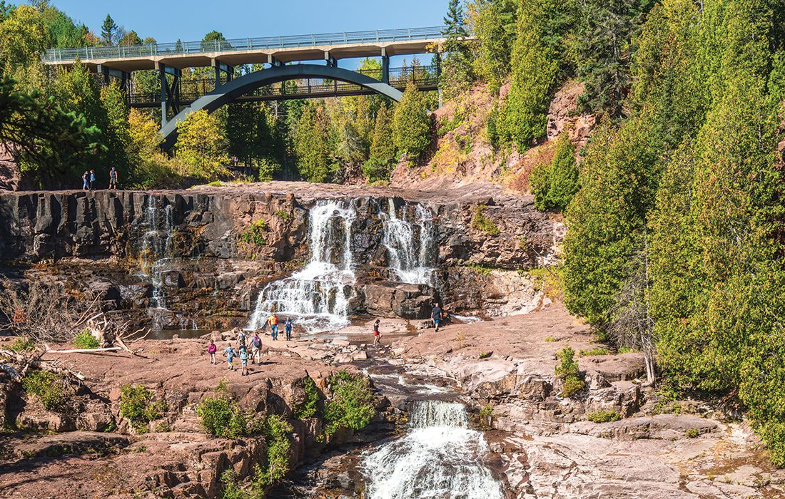
About 13 miles northeast, Gooseberry Falls State Park (Mile 39.5) is most tourists’ go-to if you only have a day. Here, massive waterfalls tumbling over basalt rock formed by lava more than a billion years ago are reached via easy, connected trails to four main areas: Upper Falls, Middle Falls, Lower East and Lower West falls. From the Upper Falls, a more rugged trail goes upstream to Fifth Falls. Round out your visit with a stop at Agate Beach and Picnic Flow, a picnic area where the lava created a pockmarked landscape.
Four miles farther, Split Rock Lighthouse State Park makes a great introduction to the rocky Lake Superior shoreline. We followed several intersecting trails to small coves, Ellingsen Island, Conundrum Point and of course, views of the lighthouse perched on a high bluff—one of the most photographed spots in Minnesota. It’s worth paying a fee to explore the lighthouse complex.
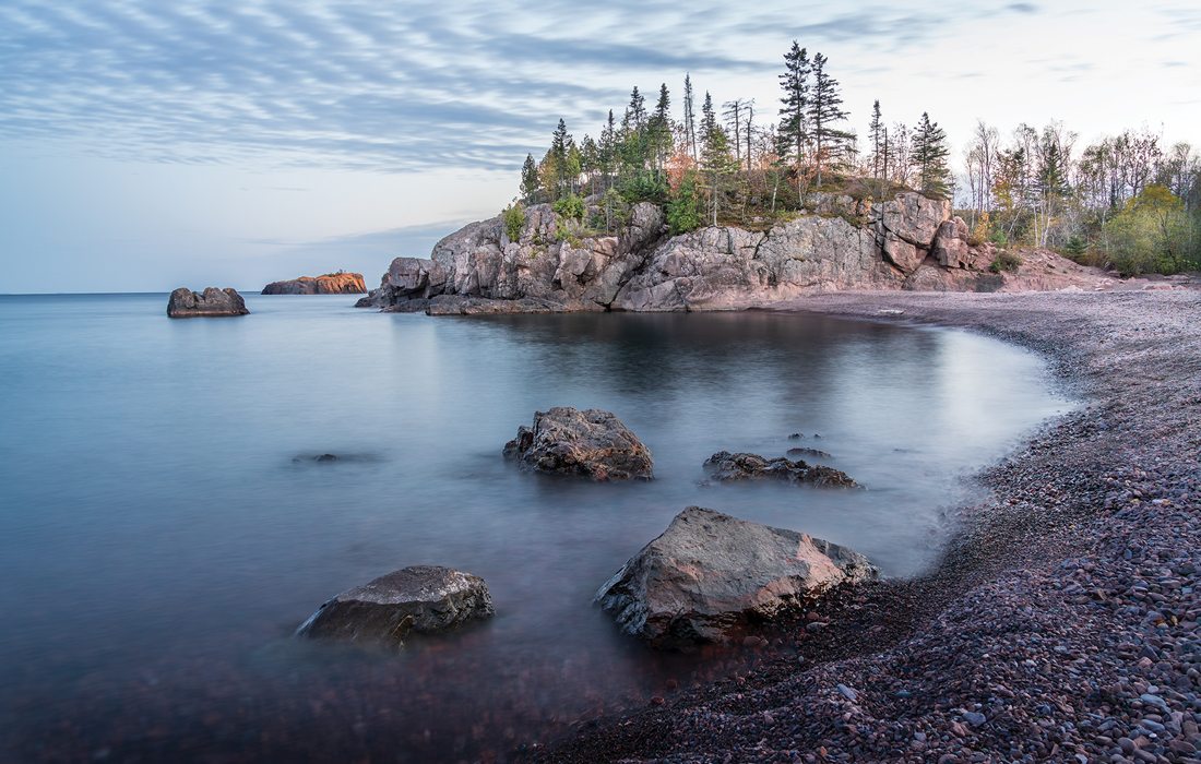
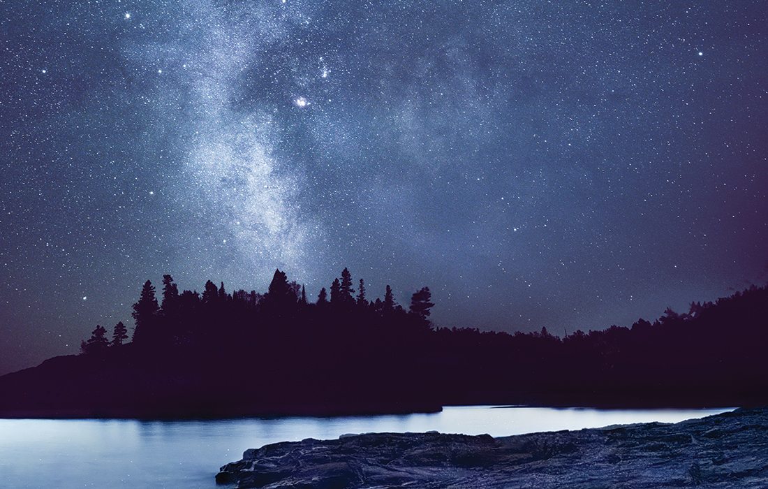
Photo by Sony HocklanderBlack Beach has a unique charcoal-colored shore and is a great picnic stop.
Tettegouche, Silver Bay and More
We only touched on things to do in the 9,300-acre Tettegouche State Park. In addition to its visitor center at Mile 57, Tettegouche includes six inland lakes, four sets of waterfalls and terrain of the Sawtooth Mountains. The park has notable overlooks including Shovel Point; we especially liked Palisade Head, soaring at 300 feet above the lake with a breathtaking vista.
For an easy adventure, walk from the visitor center to get a bridge-eye view of the Baptism River entering Lake Superior. Flooding had closed some park trails, but we hiked to the top of 63-foot High Falls for a river overlook. Later, we drove up Highway 1 to hike a short trail to the 40-foot Illgen Falls, yet another gorgeous spot located on the Baptism.
Nearby at Mile 51, Beaver Falls is one of several waterfalls you can see right off the highway. Don’t miss Black Beach (Mile 54), a great picnic stop on Silver Bay for its unique charcoal-colored crushed rock shore. Black Beach has two main sections divided by rocky outcrops. The farthest attracts most tourists, but I liked the beach closest to our campground for views of the sunrise with my morning coffee.
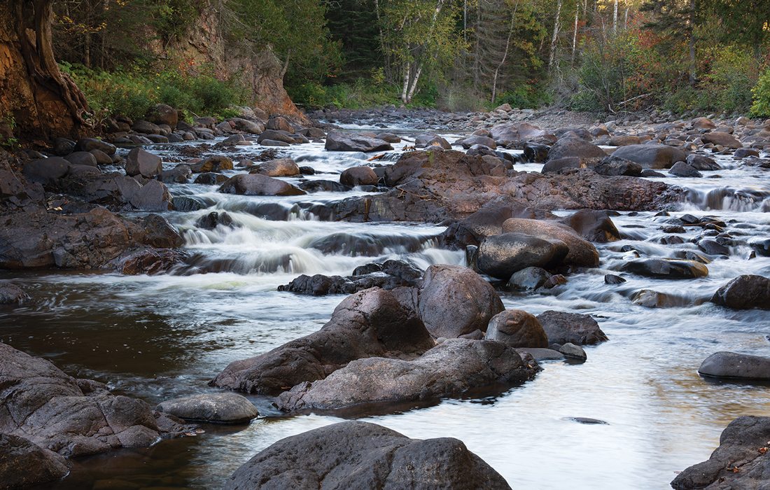
Temperance River, Cascade River and Adventures Between
Plan at least two days for adventures in the North Shore’s middle section. One picturesque waterfall adventure to Caribou Falls (Mile 70) doesn’t take long. After half a mile hiking the easy trail, which includes pretty views of cascades over pinkish rocks, walk down to the base of the 40-foot waterfall.
At Temperance River State Park (Mile 80), follow a short trail downstream from Scenic 61 to marvel as the river tumbles through a rocky gorge into a small lagoon and the lake. A couple of footbridges provide nice viewpoints.
Upstream, hikers can follow the rugged Temperence River Falls Loop Trail for nearly three miles up and back along the rocky river gorge.
We enjoyed half a day in the Sawtooth Mountains by riding the Summit Express Gondola (Mile 90.5), which soars 1,000 feet above Lake Superior for an amazing view from the Summit Chalet where we sipped brews in the warm afternoon sun.
Short hikes from the top revealed slopes exploding with fall color, including orange and red maples mixed with yellow-leafed birch and poplar trees closer to the lake.
A favorite experience was hiking a one-mile trail at Cascade River State Park (Mile 99.8). The trail leads into the forest to the first beautiful waterfall, then continues uphill with boardwalk steps, bridges and natural surfaces to reveal more cascades in a wooded setting. Returning, we saw dozens of brook trout near the river’s mouth—and anglers trying to catch them!
Photos by Sony Hocklander
Split Rock State Park (left) and Brule River (right) are must-stops on your trip.
Grand Marais to Grand Portage
The most northeastern third of Scenic 61 starts around Mile 109 with Grand Marais, a charming village with local shops, restaurants and galleries amid scenic sights. We didn’t mind waiting for a table at the popular Angry Trout Cafe while relaxing outside with a cold drink and gorgeous harbor views. Don’t miss Artist’s Point, an inspiring rock peninsula near a cobblestone beach. From Artist’s Point, walk the breakwater trail to the lighthouse at its tip.
It’s worth the drive to Grand Portage State Park (Mile 151), where High Falls plunges over a bluff to the Pigeon River. At 120 feet, it’s the state’s tallest waterfall, although it straddles the border with Canada. To see it, follow a paved path to three nice viewing platforms. We also took a side trail to the Pigeon River where Canada was yards away.
The park’s Middle Falls roars over a 20-foot drop in the riverbed. It takes a 4.5-mile rugged hike to reach on the U.S. side but hardly a hike from Canada. So we crossed the border, turned left onto Highway 593 and stopped where a short path leads to a heartstopping view of the top. From the base we could see hikers across the river.
Heading back, we stopped at Judge C.R. Magney State Park (Mile 124) for a hike to Devil’s Kettle Falls, the North Shore’s most mysterious waterfall. The two-mile out-and-back trail climbs up and down roughly 175 steps with a 400-foot elevation change along the Brule River. At the end, hikers are rewarded with two waterfalls.
Devil’s Kettle Falls splits around rocks to form a double stream, one of which vanishes into a rocky hole (the “kettle”). But where does it go from there? After puzzling visitors for years, the mystery was solved about seven years ago when scientists proved it simply rejoins the stream.
While we didn’t see everything we’d like to in a week, I know we’ll go back to the North Shore: This vacation spot is too gorgeous to visit only once.
Plan Your Trip from Springfield, Missouri to Minnesota
North Shore begins in Deluth, 750 miles north of Springfield (about 12 hours away by car). Visitors need a Minnesota State Park vehicle permit ($7/day or $35/year) to visit state parks. Accommodations vary. There are numerous private or state park campgrounds. Resorts, cabins and hotels can be found around each community, or you can look for a rental property along the shore or up in the mountains. Learn more about the area at North Shore Visitor.