


Travel
Best Fall Drives Through the Ozarks
Head to these scenic byways for a beautiful view of the changing leaves. Pack a sweater and hiking boots to explore the trails and rivers along the way.
By Katie Pollock Estes and Jo Everhart
Oct 2023
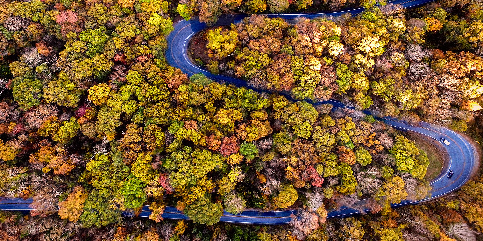
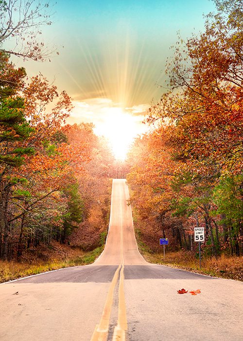
Photo by Alex JaredLook at those twists and turns! Check out the Pig Trail Scenic Byway in northwest Arkansas, just a short drive away.
Are you ready to leave your to-do list behind, hop in the car and explore some Ozarks roadside vistas? We sure are. We love hitting the open road with a good soundtrack and some great snacks, following the curves and bends and admiring bursting fall color. As you keep an eye on peak fall foliage and find free weekend moments that beg for exploration, use this feature as your guide to getting started.
Photos courtesy Arkansas Department of Parks & TourismThe switchbacks along the Pig Trail Scenic Byway make this a fun route to drive.
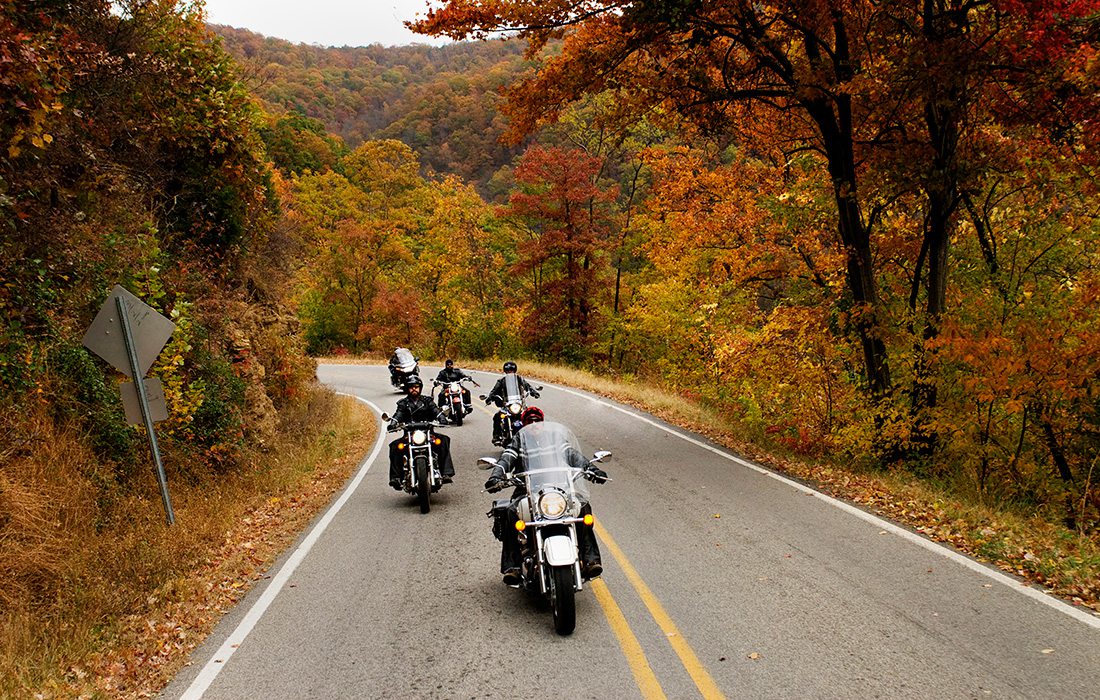
Photos courtesy Arkansas Department of Parks & TourismThe Pig Trail’s twists make it a popular route with motorcyclists.
Photos courtesy Arkansas Department of Parks & TourismAnd crossing the Mulberry River is a rewarding treat.
Pig Trail Scenic Byway
How to Find It: Start in Eureka Springs, Arkansas. Check the map and plan your trip.
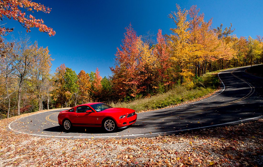
The Drive: Your view on this trek is of Northwest Arkansas’s Boston Mountains, which erupt in bright oranges and yellows when fall foliage is at its peak. This path’s curving switchbacks are popular among motorcyclists, and while the route is just a short 19 miles, its views are rewarding as drivers cross the Mulberry River.
More Ways to See Fall Color in the Ozarks
417 Magazine Publisher Logan Aguirre shares her favorite fall drives with KY3's The Place
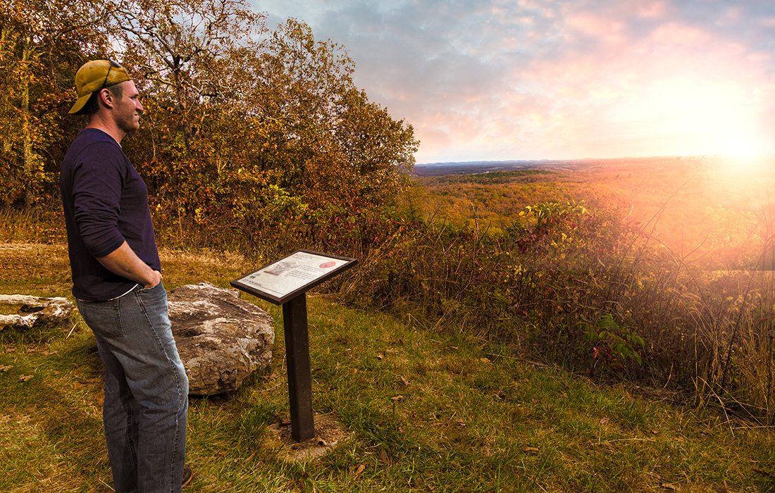
Photos by Abby GustThe Arkansas View scenic pullover is just one of the many stops you can make along the Glade Top Trail.
Purchase Photo
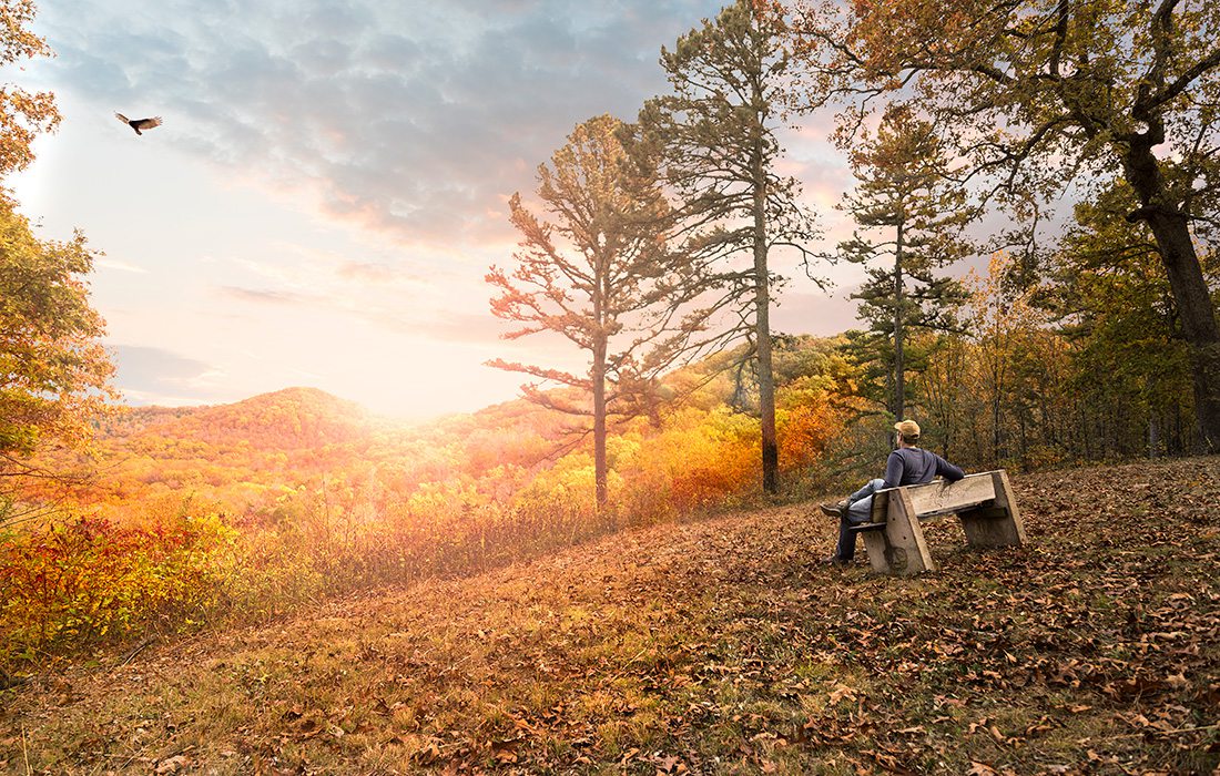
Photos by Abby GustThe views along Glade Top National Forest Scenic Byway are breathtaking.
Purchase Photo
Glade Top National Forest Scenic Byway
How to Find It: Start in Ava. Check the map and plan your trip.
The Drive: Following a high ridge through dense woods, this byway gives you all the Missouri autumn feels. Stop at the pullouts and stretch your legs while you look out over sweeping Mark Twain National Forest vistas. The byway splits partway through for a choose-your-own-adventure drive. You can end at either Longrun or State Highway 125 or backtrack through, so you can enjoy the full 23 miles of byway.
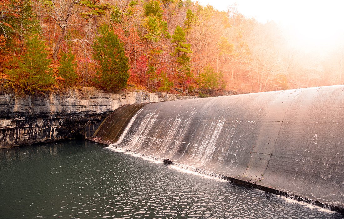
Photos by Kevin O'RileyBe sure to stop by the Noblett Lake dam, built in the 1930s.
Purchase Photo
Photos by Kevin O'RileyTake in Mark Twain National Forest as you traverse the rolling hills along Blue Buck Knob.
Purchase Photo
Blue Buck Knob National Forest Scenic Byway
How to Find It: Start in Cabool. Check the map and plan your trip.
The Drive: Mark Twain National Forest is the backdrop for this drive. You’ll climb hills, cross Indian Creek and take in beautiful fall color along the way. You’ll want to make sure you leave some time to hop out of the car at Noblett Lake Recreation Area, where you can give the kids a little history lesson on the Civilian Conservation Corps while you check out Noblett Lake Dam. (They built the curved structure that cuts across the length of the waterway.) To make a day of it, you can also take a detour (either on the way there or on the way home) to hike at the Cedar Gap Conservation Area, located about halfway between Blue Buck Knob and Springfield.
Dine Along the Way: Swing into Mountain Grove on the way home for a catfish or fried chicken dinner from The Grove Family Restaurant (2130 N. Main Ave., Mountain Grove, 417-926-1638).
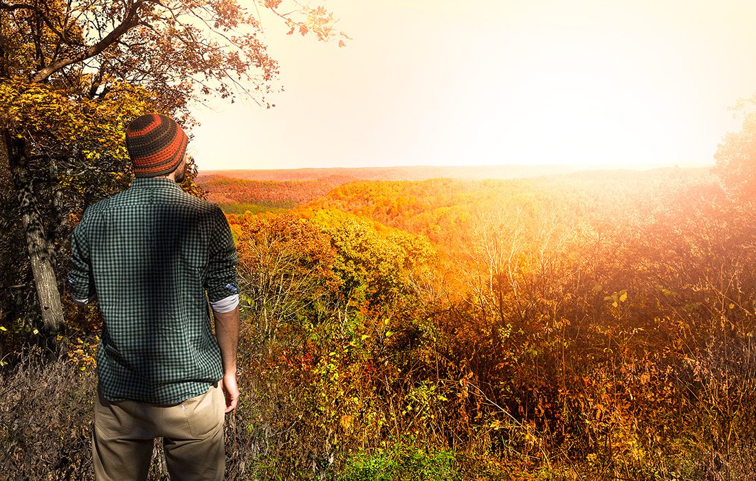
Photo by Vivian WheelerBuild in enough time to stop along the Sugar Camp National Forest Scenic Byway to take in the scenery.
Purchase Photo
Sugar Camp National Forest Scenic Byway
How to Find It: Start in Cassville. Check the map and plan your trip.
The Drive: In addition to the fiery colors of a southwest Missouri fall that bring these rolling hills and valleys to life, you’ll get to see a Civilian Conservation Corps fire tower. The road is gravel for 8 miles of the trek, but some of the prettiest sights are along that stretch.
Dine Along the Way: Midway between Springfield and the byway, stop at Hog Tide Bar-B-Que (22020 Lawrence 1200, Aurora, 417-308-3525) for killer brisket.
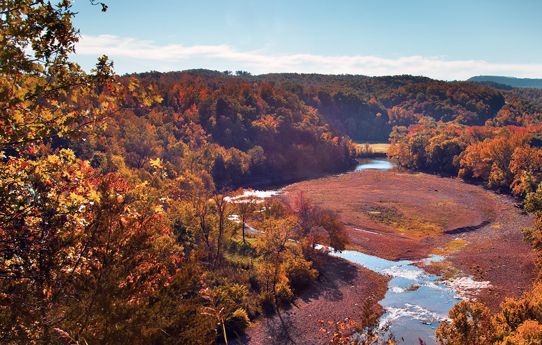
Photo by Brandon AlmsTake your time and stop at overlooks like this one at the Buffalo River Valley in Arkansas.
Purchase Photo
Arkansas's Scenic 7 Byway
How to Find It: Head south of Springfield to Harrison, Arkansas. From there, you’ll head further south on the byway (aka Highway 7) toward Russellville. Check the map and plan your trip.
The Drive: This is a great drive for lovers of Arkansas because you’ll see some of the area’s prettiest spots, like the quartz-filled Ouachita Mountains, the Arkansas River Valley, the Ozark Mountains and the Buffalo National River. The towns of Harrison, Jasper and Hot Springs all offer nearby options for meandering side ventures, although the drive is gorgeous even if you never pull off.
Dine Along the Way: At the Cliff House Inn (6 Highway 7, Jasper, AR) you can peep the breathtaking Grand Canyon of the Ozarks after you grab a bite. If you’ve made a long day of this road trip and need a rest, you can even spend the night at the inn. Hot tip: You really need to be there at sunrise! It’s gorgeous.
[EDITOR'S NOTE: This story was updated October 2023.]

